Products

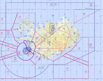
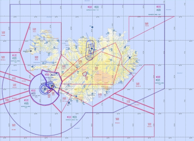
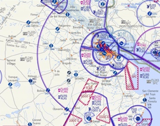
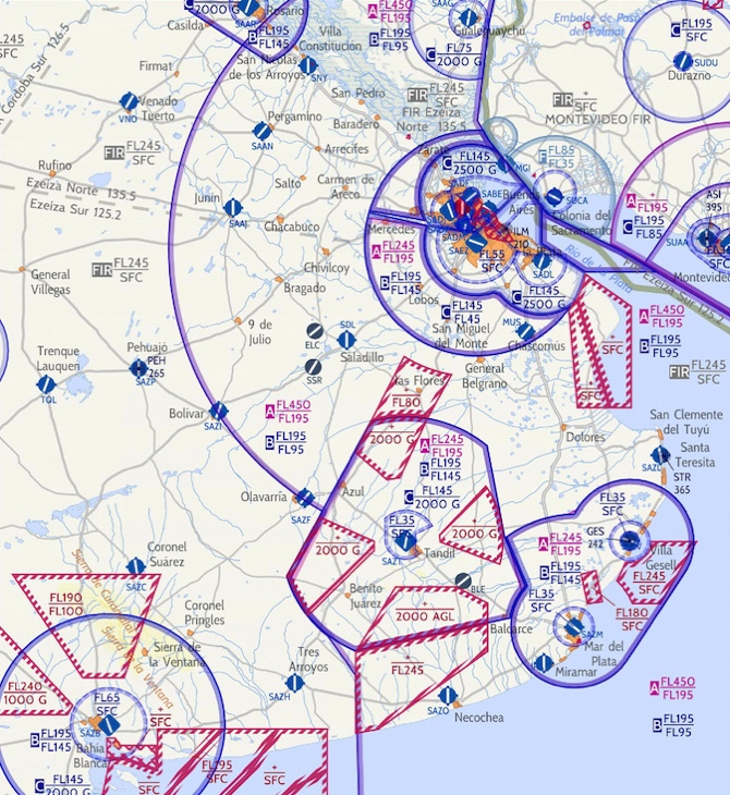
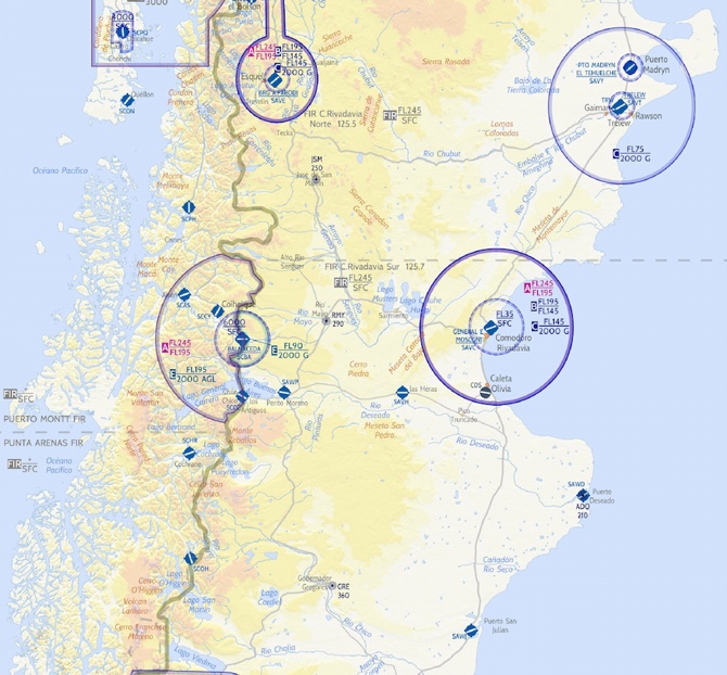
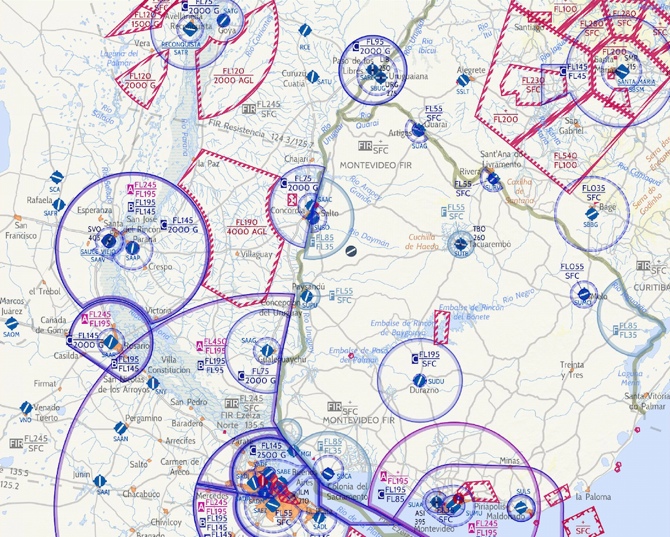
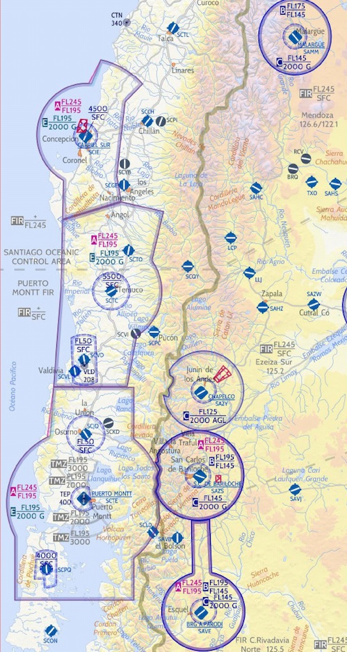
All our VFR charts are designed for aeronautical applications and can be easily converted to be displayed on any devices. Thank to our standard raster geotiff WGS84 and png format. If the VFR chart you are looking for is not yet available, do not hesitate to contact us.

You want to be informed of new VFR charts releases? Please subscribe to our newsletter below.

Mexico VFR Chart 500K

The Mexico VFR Charts Cover 100% Of The Country Territory. The Charts Has All The AIP Information Combine With Private Data, Carefully Checked And Updated Through A Triangular Checking Process, To Guarantee The Quality Of The Data Displayed.

Canada VFR Chart 500K

The Canada VFR Charts Cover 100% Of The Country Territory. The Charts Has All The AIP Information Combine With Private Data, Carefully Checked And Updated Through A Triangular Checking Process, To Guarantee The Quality Of The Data Displayed.

New vfr charts coming soon

We are working actively to deliver new maps.
Are you looking for a specific map not yet available? Please contact us.

Australia VFR Chart 500K

The Australia VFR Charts Cover 100% Of The Country Territory. The Charts Has All The AIP Information Combine With Private Data, Carefully Checked And Updated Through A Triangular Checking Process, To Guarantee The Quality Of The Data Displayed.

Philippines VFR Chart 500K

The Philippines VFR Charts cover 100% of the country territory. The Charts has all the AIP information combine with Private data, carefully checked and updated through a triangular checking process, to guarantee the quality of the data displayed.

Spain and Portugal VFR Chart 500K

The Spain and Portugal VFR Charts cover 100% of the country territory. The Charts has all the AIP information combine with Private data, carefully checked and updated through a triangular checking process, to guarantee the quality of the data displayed.

Southwestern Colombia and North-Eastern Ecuador VFR Chart 500K

The Southwestern Colombia and North Eastern Ecuador VFR Charts cover 100% of the country territory. The Charts has all the AIP information combine with Private data, carefully checked and updated through a triangular checking process, to guarantee the quality of the data displayed.

Chile Santiago Central and North VFR Chart 500K

The Chile Santiago Central and North VFR Charts cover 100% of the country territory. The Charts has all the AIP information combine with Private data, carefully checked and updated through a triangular checking process, to guarantee the quality of the data displayed.

Venezuela West and Columbia Center VFR Chart 500K

The Venezuela West and Columbia Center VFR Charts cover 100% of the country territory. The Charts has all the AIP information combine with Private data, carefully checked and updated through a triangular checking process, to guarantee the quality of the data displayed.

Colombia North VFR Chart 500K

The Colombia North VFR Charts cover 100% of the country territory. The Charts has all the AIP information combine with Private data, carefully checked and updated through a triangular checking process, to guarantee the quality of the data displayed.

Argentina Cordoba & Mendoza VFR Chart 500k

The Argentina Cordoba & Mendoza VFR Charts cover 100% of the country territory. The Charts has all the AIP information combine with Private data, carefully checked and updated through a triangular checking process, to guarantee the quality of the data displayed.

Iceland VFR Chart 500K

The Iceland VFR Charts cover 100% of the country territory. The Charts has all the AIP information combine with Private data, carefully checked and updated through a triangular checking process, to guarantee the quality of the data displayed.

Argentina Buenos Aires VFR Chart 500K

The Argentina Buenos Aires VFR Charts cover 100% of the country territory. The Charts has all the AIP information combine with Private data, carefully checked and updated through a triangular checking process, to guarantee the quality of the data displayed.

Argentina La Pampa & Rio Negro Neuquén VFR Char 500K

The Argentina La Pampa & Rio Negro Neuquén VFR Charts cover 100% of the country territory. The Charts has all the AIP information combine with Private data, carefully checked and updated through a triangular checking process, to guarantee the quality of the data displayed.

Far South Argentina and South Chile VFR Chart 500K

The Far South Argentina and South Chile - Santa Cruz-Tierra del Fuego, South Patagonia & Strait of Magellan VFR Charts cover 100% of the country territory. 

South Argentina and Chile VFR Chart 500K

The South Argentina and Chile – Chubut, North Santa Cruz & North Patagonia VFR Charts cover 100% of the country territory. 

Uruguay & North Buenos Aires VFR Chart 500K

The Uruguay & North Buenos Aires VFR Charts cover 100% of the country territory. The Charts has all the AIP information combine with Private data, carefully checked and updated through a triangular checking process, to guarantee the quality of the data displayed.

Chile Concepcion and Puerto Montt VFR Chart 500K

The Chile Concepcion and Puerto Montt VFR Charts cover 100% of the country territory. The Charts has all the AIP information combine with Private data, carefully checked and updated through a triangular checking process, to guarantee the quality of the data displayed.